

CARTOGRAPHIE DU POTENTIEL EN BAS-FONDS AMENAGEABLES DE LA COMMUNE DE MATERI AU BENIN
Date de Publication : Octobre 2016 | RGO N°005 Volume 02 | Page No.:69-89
ISSN : 2424-7375
Télécharger PDF
RESUME : Depuis une trentaine d’années, de nombreux programmes et projets de recherche interviennent dans la mise en valeur des bas-fonds, devenue aujourd’hui l’une des stratégies d’adaptation de l’agriculture aux changements climatiques. L’identification de ces agro-écosystèmes de bas-fonds s’avère nécessaire pour les perspectives agricoles. La présente étude vise à cartographier le potentiel en bas-fonds aménageables de la commune de Matéri situé au nord-ouest du Bénin.
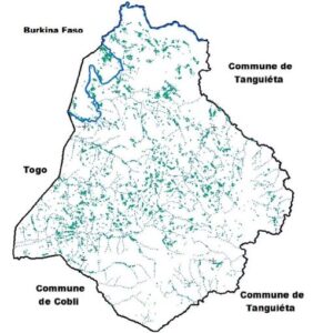
L’approche méthodologique adoptée a combiné le NDVI (Indice Normalisé de Végétation) généré à partir de l’image Landsat ETM+, la pente extraite du traitement numérique de l’image ASTER DEM et les zones d’accumulation d’eau générées également à partir de l’image satellitaire ASTER DEM. La commune de Matéri est pourvue en zones humides occupant 25 % de sa superficie. Environ 4928 bas-fonds aménageables couvrant une superficie de 53 km² (soit 3,05 % de la surface totale) ont été identifiés.
Mots clés : Bas-fond, télédétection, inventaire, cartographie, Matéri, Bénin.
ABSTRACT:
Since about thirty years many programmes and research projects have been developed for the planning of the inland valleys, this planning becomes nowadays one of the strategies of agriculture for the adaptation to the climatic changes. The identification of these agro-ecosystems of inland valleys is necessary for the agricultural perspectives. This study aims at mapping the potential in wetlands in the north west of Benin.
The methodological approach has combined the NDVI generated from a Landsat ETM+ image, the slope extracted from ASTER DEM and the accumulation areas generated also from that DEM. Materi district possesses humid areas, upon 25% of her area. About 4928 wetlands developable have been identified covering a 53 km2 area (about 3.05% of the total surface). About 82% of those wetlands GPS points taken in the field correspond to the one inventoried through the processing of satellite images.
Key Words: Wetlands, Remote Sensing, Inventory, Mapping, Materi, Bénin.